Friday 23 October 2009

Bolivia: Copacobama and on to La Paz


Arrived in Copacobama after a 4 hour journey from Puno through the Peru/Bolivian border control, which as these things go was pretty much straight forward. Copacobama is small town situated on Lake Titicaca and is seen as a place to relax for both foreigners and Bolivians alike. Copacobama, as with Cusco, has expanded exponentially in the last 5 years or so which has placed a tremendous strain on its` infrastructure, for example, roads and waste disposal are poor, then Bolivia is one of the poorer developing of South America, struggling to keep up with its richer neighbours. Despite all of this Copacobama had a laid back atmosphere and I found a hotel with a room with a view overlooking the lake, both cheap and comfortable, if a little worn around the edges.
I stayed for a week in the town with one night on the Isla del Sol (the Inca birthplace of the sun). During my stay I completed the 17km hike to Yampupata and then caught a private boat over the strait to Yamuni on the Isla del Sol. A great walk from Copacobama to Yamputata was on dirt road which mainly followed the coastline. The weather was perfect, a clear sunny day, ideal for hiking, where the only person I met was Hilario at Sicuana in his reed boat. The Lonely Planet Guide had mentioned Hilario and I was still surprised when I was hailed and offered the opportunity to sail in her/him (male or female in Inca history with the panther prow?) for a small donation. Relaxing on the boat with 4 Frenchmen who were also taking time out from hiking though the other way, to Copacobama, was a peaceful experience as Hilario punted us through the reeds on Lake Titicaca, where I took the opportunity to enjoy my packed lunch in this unusual setting!
A further 4km hike to Yampupata and I found a boat to take me to the south of the Isla del Sol, for ten dollars, where I stepped onto a very basic pier, unexpectedly, this was about 3 km from Yumani. In Yumani it was relatively straightforward to find accommodation, though this involved a climb to the highest point of the village, which given I was rather tired was not entirely welcome! The one nights´accommodation was of a surprisingly high standard, bathroom ensuite, and cheap, giving spectacular views over Lake Titicaca. The next morning I set out for Challapampa, on the north of the island a hike of 4 hours, of between 12 and 17 kilometres, were again I climbed to high altitudes of 4,200m, along the spine of the island. Yet more spectacular views were to be had, and the weather was clear and sunny with a breeze at the highest points. Needless to say I was well prepared with sunscreen, hat and covered arms and legs. I met a number of other hikers on the way all of whom caught the same ferry back to Copacabama, a journey of one and a half hours that became a nightmare journey of two hours when a storm blew up. The small ferry was packed with people and it yawed and pitched in the high seas on the lake, half of the passengers were very seasick, though I avoided this as I kept busy by helping with the sick passengers (plastic bags were at a premium on this journey!).
I spent the next 2 nights recovering from the experience, in Copacabama, visiting some of the local sights, including Calvary Hill and enjoying a swim in the not-so-cold lake in the next bay along to the town.
Sadly I was unable to find a massage place in Copacabama, as my usual practice was to have a full massage after a hike, but that had to wait until La Paz. The 4 hour coach journey in a ´tourist´bus was not without its own entertainment when we disembarked whilst the coach was loaded onto a ´ferry´to cross the straits (see photo!). We were taken across on a small motor launch which, of course, was packed to the gunnells....
First impressions of La Paz, the highest capital city in the world at an altitude of 3,600m, was of a bustling, large and crowded city, fortunately, as always I had booked a hotel through Hostelworld, beforehand, and the bus dropped us about 200 yards away.
Photo 1. The Cathedral, Copacobama, viewed through the main gate.
Photo 2. Sunset over Lake Titicaca, seen from my hotel room.
Photo 3. A farmer waters his pigs by the lakeside.
Photo 4. Copacobama viewed from Calvary Hill overlooking the town.
Photo 5. Calvary Hill seen from the Inca ruins (in a very poor state of repair with much graffiti and destruction of the fabric of the ruins.
Photo 6. A wedding on the lakeside. The women all over Bolivia wear this traditional dress of bowler hat and full skirt with many petticoates. This group were dancing in pairs along the lake.
Photo 7. An island on the lake, complete with fish farm (trout are commonly farmed on Lake Titicaca and are standard food on all restaurant menues) . Alongside the farm is a floating island (a feature of the lake, and composed of a mat of reeds) where the farmer has his home.
Photo 8, 9, 10. The reed boat with its panther prow. This particular boat took Hilario 2 weeks to build with the help of 4 friends (and generous brewing of coca leaf tea, to be recommended when dealing with high altitudes). The boat will last for about a year when they will build another one!
Photo 11. An alpine flower seen at approximately 3,800 m.
Photo 12. The view of the lake from the top of the ridge along the island.
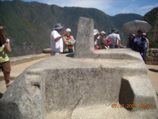
Photo 13. Sitting on the altar stone at the rather disappointing Inca Temple of the Sun.
Photo 14. The bus to La Paz, being driven onto the ferry, hazardous or what?

Tuesday 20 October 2009

Lares Trail and on to Bolivia via Puno


Setting aside the first day of the Lares Trail, making a 4 day instead of 3day trail, was a decision I did not regret. We arrived in Lares on a public bus (as in Nepal an experience to be treated with caution, and not too uncomfortable!) before lunchtime, and checked into a very basic hostal near the hot springs. As it was a Sunday the springs were busy but that did not detract from the pleasure of soaking in the various pools set at different temperatures, from about 38C to 42C
The next 3 days were challenging physically involving hiking to 2 passes of 4,200 metres through very sparse countryside where we met the few local people who mainly farmed alpaca, lama and sheep. Everyone we met dressed in traditional Peruvian clothes, mostly made themselves. Their homes were extremely basic and wither made from mudbricks or rocks and stones collected locally with grass roofs. The 2 nights I spent in a tent (though my guide and porter slept in the hut on the first night and complained of a lack of sleep due to the guinea pigs running amock!
This trek differed greatly from the Macchu Picchu trail as we did not see any other tourists in the whole of the 4 days, and were able to gain an insight into the lives of the indigenous people as opposed to being battered at every point on the trail by vendors selling their wares. The people I met on the Lares trek were so very much poorer than the people we met on the sanitised Inca Trail, and had been warned that this was so and took fruit (unavailable in their diet at the higher altitudes, the staple foods were potatoes, rice and some maize) and trinket gifts for the children, as well as willingly paying when permitted to take a photo.
The final day of the trek was approximately 17km with a climb along a narrow, treacherous path to the Marcoconcha Pass at 4,200m followed by a punishing (on the knees) downhill journey of two and a half hours to Yanahuara and a minibus to Urubamba and a local bus to Cusco and a welcome hot shower!
The next day was a day of rest in Cusco before heading, by tourist bus, to Puno and my first sight of Lake Titicaca. Puno was rather grim , and definitely without the charm of Cusco and also a lot less affluent and lacked the large tourist trade of Cusco. The town centre nevetheless was busy and the buildings(including the inevitable gothic style cathedral) having a strong colonial Spanish influence. The rest of the town was very typical and had many unfinished houses, many of which were mudbrick and unpaved roads characterised by the presence of mudpiles causing obstructions.
The 2 night stay in Puno was redeemed by a half day visit to Sillustani, a hillside cemetary with a history going back pre-Christian times. The whole experience was enhanced by an excellent guide and a decent tour bus for the one hour journey from Puno (all for the equivalent of 5 British pounds!). Returning from Sillustani we visited a farm and were able to view weaving and the livestock of sheep, lama, and alpaca´s at close quarters.
The next part of my journey was to Bolivia and the lakeside town of Copacabamba where I planned to enjoy stay for a few days and hike to the Isle Del Sol (taking a boat over to the island!) on Lake Titicaca.
Photo 1. The hot springs at Lares on Day 1. A very busy day, being a Sunday when families came from far and wide to enjoy the springs.
Photo 2. The mudbrick church tower in Huachuasi.
Photo 3. Two village children in traditional costume in the village of Huacahuasi, where we had our lunch on Day 2 in a horse paddock. This village was one of the poorest I´d seen in Peru.
Photo 4. The farmhouse where we took shelter during the worst of the hailstorm. We were fed delicious boiled new potatoes to help us warm up alongside the inevitable coca tea, which we supplied.
Photo 5. An earlier view of the approaching storm.
Photo 6. The shepherd´s hut where we stayed on the second night. NB my tent in the sheepfold (no visible grass just sheep sh!).
Photo 7. Looking back with a spectacular view of the high Andes in the background, taken from the sheperdesses hut on Day 2.
Photo 8. The valley as it appeared on reaching the Marconcha pass. From theron in it was a long haul downhill., Day 4.
Photo 9. A 100 year old working shepherd whom we met on the route to Patacancha where we had lunch in a farmyard on Day 3.
Photo 10. A further view of the distant road to Ollantaytambo from the approach to Marcaconcha Pass
Photo 11. A rather fine example of an alpine flower seen on Day 4 as we climbed towards the Marcaconcha Pass
Photo 12. The view from the route to the second pass, looking towards Ollantaytambo, on Day 4.
Photo 13. The advert for the village shop, a red plastic bag on a pole.
Photo 14. The hillside´s in Peru were often used to advertise a town or products.
Photo 15. The main surviving burial tower at Sillustani. The higher ranking Inca´s were buried here, mummified in a foetal position. There would be up to 10 mummies in the tower.
Photo 16. The remains of the Temple of the Sun and the Temple of the Moon at Sillustani.
Photo 17. A group of local children at Sillustani with their pet lamb.
Photo 18. Made it to the pass at Ipsaycocha (4200m), on Day 2.
Photo 19. The farmers wife with her lama, seen on our journey back from Sillustani.
Photo 20. Looking back down the valley towards Lares at the approaching storm on Day 2.
Photo 21. View down the valley towards Yanahuara after the pass at Marcaconcha.
Photo 22. The elderly sheperdess and her grandaughter in her hut where we stayed on night 2.


Friday 9 October 2009

South America and the first stop, Peru


Finally arrived in Peru following an arduous 17 hour journey from New Zealand, feeling disorientated and tired but went immediately to join the Gap Inca Trail tour starting on the 1st October for a 6 day journey to the Sacred Valley and then on to the 4 day hike of the Inca Trail with an international group of 15. I met with , Amanda, from Eire,
and we spent the next 7 days in each others´ company, sharing rooms and tents.
The Sacred Valley tour of Pisac, the ruins of the 14th-15th century Inca city, though crowded gave us our first site of Inca ruins in sunny and warm weather conditions, given the increasingly high rainfall through October and into November at this time of the year. Staying in a hostal in Ollantaytambo we viewed this towns` Inca ruins , which again involved some steep inclines through the now familiar Inca terraces, it proved good preparation for the hikes to come! The next morning we set out for the beginning of the Inca Trail, starting at the 82km marker point at Piskacuchu. Walking for 4hrs we climbed steadily, reaching higher altitudes and our night camp of Wallabamba at 3200m, stopping at Llactapata, an Inca ruin on the way. The sub tropical fauna consisted of mainly eucalytus trees (surprised by this)and some cactus and succulent plants, often edible. First night sleeping in tents was fairly difficult, largely due to a thunderstorm and heavy rain which hit us early evening. However rising at 0500 and starting on the trail by 0700 was to become the norm! The food was good, traditional Peruvian fare, cooked on site, every meal included locally grown potatoes and always with the option of fresh onion and fresh chilli peppers. The second day was the most gruelling with a climb to Warmiwanusca (Dead Woman Pass) at an altitude of 4,215m, a climb of 1300m in four and a half hours. A further hike of 2 hours, downhill on the old Inca Trail proved very tough on the knees, but we were rewarded with truly spectacular views of the surrounding mountain ranges with sub-tropical alpine vegetation (many bamboos). Tea and Dinner at the Papymayo camp filled the hole in our bellies after the 7-8 hour hike and despite more heavy rain I think everyone slept the sleep of the dead.
Day 3 of the trail was supposedly less gruelling though involved ascending to the Runkuraqay Pass at 3,760m followed by a visit to the ruins at Phutupatamarca, through similar terrain as on previous days, and still following the Inca trail, basically a rough and uneven stone footpath.

Before reaching camp we were able to walk through the ruins at Intipata, another agricultural community consisting mainly of wide terraces. The last camp before Machu Picchu itself was blessed with hot showers so there was generally a rush to clean up after 3 days of blood, sweat and near tears! The downside of Day 4 was the need to be up (0400) and walking (fast) on the final morning to reach the Sungate Temple by sunrise, which would give our first view of the city of Macchu Picchu. I made it at considerable personal physical cost but it was worthwhile and only requiring a further half hours´ walk down to the city of Machu Picchu.

Without doubt the remains of this civilisation, destroyed by the conquering Spaniards, rightly belongs in the category of a World Heritage Sight. The extent of this city, thought to be a place of rest and relaxation for the high Inca´s (though there are differing opinions on this), is breathtaking on first sight. The day was hot, but we arrived before the heat became generally too much, shelter being sparse, in time for a tour by Marcello, our guide, and also before the city become overcrowded with visitors who had arrived by bus from Agua Caliente. Walking poles were not permitted so we negotiated the steep steps in the city without their use, tricky when I was used to their support.

Afterwards we took the bus down to Agua Calientes where after having had lunch, 6 of us rushed up to the hot springs and soaked for half an hour before catching the train to Ollantaytambo, followed by a coach to Cusco. We booked back into the Prisma Hotel and spent the next 24 hours celebrating our achievement before we dispersed to our varied next destinations. I booked the Lares Trail, but first spending two and a half days in Cusco relaxing with full massage, and haircut etc. The Lares trail was a 4 day trail starting with a day at the Lares hot springs. This gruelling trail with guide, porter/cook with horse, was an opportunity to meet the rural people of Peru, and also very much off the tourist trail.

I must apologise for any confusion caused by the lack of a chronological order in displaying the following photo´s.

Photo 1. The group at the 82km point at Piskacuchu, the start of the trail.

Photo 2. Llactapata Inca ruins, and taking a well earned rest.

Photo 3. The view from half way up to Dead Woman´Pass.

Photo 4. The happy/relieved group at the pass.

Photo 5. Macchu Picchu viewed from the Temple of the Sun (taken at about 06.30).

Photo 6. The view of the surrounding mountains from the Temple of Water, including members of my tour group.

Photo 7. The Temple of the Sun, viewed from above.

Photo 8. The Sundial (the top was partly destroyed by Budweiser when filming an advert (!!) , evidence that the Inca`s were also interested in the sciences (detailed evidence of their skills in astronomy were well documented).

Photo 9. Relaxing in the heat on the site of one of the many temples of Macchu Piccu.

Photo 10. Peruvian Rail train to Ollantaytambu. An interesting journey, highly scenic, however the ´backpacker contingent´were placed in the two more basic end carriages (!) and obliged to finish their journey at Ollantaytambo, and complete their journey by bus to Cusco....

Photo 11. A colourful religious parade in Cusco, seen on my 2 day R&R in Cusco.

Photo 12. Lunch with my fellow Inca Trail hikers in a Peruvian Bar. We were lucky enough to arrive as the band started playing. They were so good on the ear that I purchased their CD.

Photo 13. Cusco viewed from the Inca Museum (not very impressive!) looking towards the main square of San Francisco.

Photo 14. The cathedral in San Francisco Square.

Photo 15. The Andes seen on Day 3 of the trail

Photo 16. Amanda and I, with Wanda in the background taking a break - again.

Photo 17. The ruins of Sayac Marca on Day 2.

Photo 18. Intipata, the final site viewed before Machu Picchu.

Photo 19. as above (still haven´t figured out how to delete......)

Photo 20. The dawn on Day 4, before we were able to pass the final official gate to Macchu Picchu.

Photo 21. A further repeat!